Monitoring of Øresund Bridge
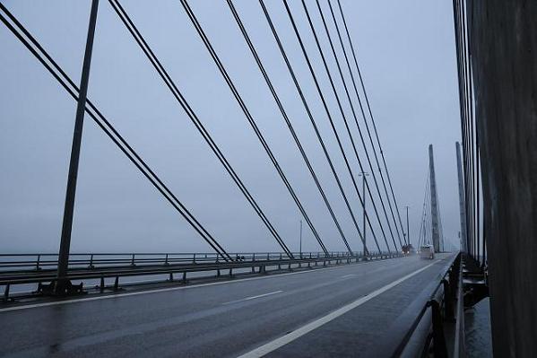
Figure 1: View of Øresund bridge and its cables from the deck.
The 16 km bridge across the Øresund links Denmark and Sweden near Denmark's capital city Copenhagen and the city of Malmö on the Swedish side. The link, one of the world's largest of its type, consists of a bridge, an artificial island and an immersed tunnel. The bridge section comprises two approach bridges, built on piers, and a high bridge across the Flintrännan navigation channel on the Swedish side. With its 490m long free span, the high bridge is the world's longest cable-stayed bridge for both road and railway. The high bridge is a simple and strong truss bridge with stylistically consistent pylons. The cables are part of a pure, well-balanced pattern with identical angles towards the pylons and are positioned outside the bridge platform to protect them against collisions. The stay cables are parallel and symmetrical around the pylon towers which, therefore, receive an evenly distributed load. Under certain light and weather conditions the cables become invisible leaving the pylons as the most prominent part of the link. The pylons stand out as four monumental towers whose dimensions reduce from sea level and upwards and thus enhance the sense of strength and stability. The inclination on the inner side of the pylons has been adjusted so that the individual tower does not appear to incline inwards. [1]
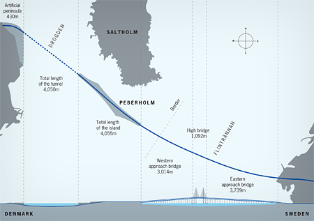
Figure 2: Location of the Øresund Bridge between Denmark and Sweden.
The monitoring of this bridge is similar to the monitoring of Great Belt Bridge concerning the acquisition of same set of data from a meteorological station, consisting of three ultrasonic anemometers and a rain gauge (collecting data about wind velocity, wind direction, events of rains, atmospheric pressure, relative humidity and temperature) and data from accelerometers installed on the stay cables of the bridge.
Currently, following instruments are installed on the Øresund Bridge:
-
1 ultrasonic anemometers on the top of south-west pylon;
-
1 ultrasonic anemometers at the deck level between the second and third hanger from the south-west pylon toward east, standing 7 meter above the road level;
-
1 ultrasonic anemometers at the deck level at the center of midspan;
-
1 rain gauge on the top of south-west pylon, standing 3 meters above the top;
-
4 accelerometers on four longest cables (1st and 2nd longest cable on the centre span on the southern side of the bridge);
-
a control system to gather and store data in digital format for analysis.
A video show the position of instruments on bridge and the next improvements of the system.
Developments
Many developments are on the way. We are planning to extend the monitoring system to have information about the accelerations of the tower and of the deck to have a better idea about the whole dynamic behaviour of the bridge. In the following weeks it´s also planned to set up a Virtual Protocol Network (VPN) to have remote access to the monitoring system. this latter issue is probably ready in few weeks from now.
References
[1] "The Link".Øresundsbro Konsortiet A/S.
[2] "The Great belt fixed link". wikipedia.org